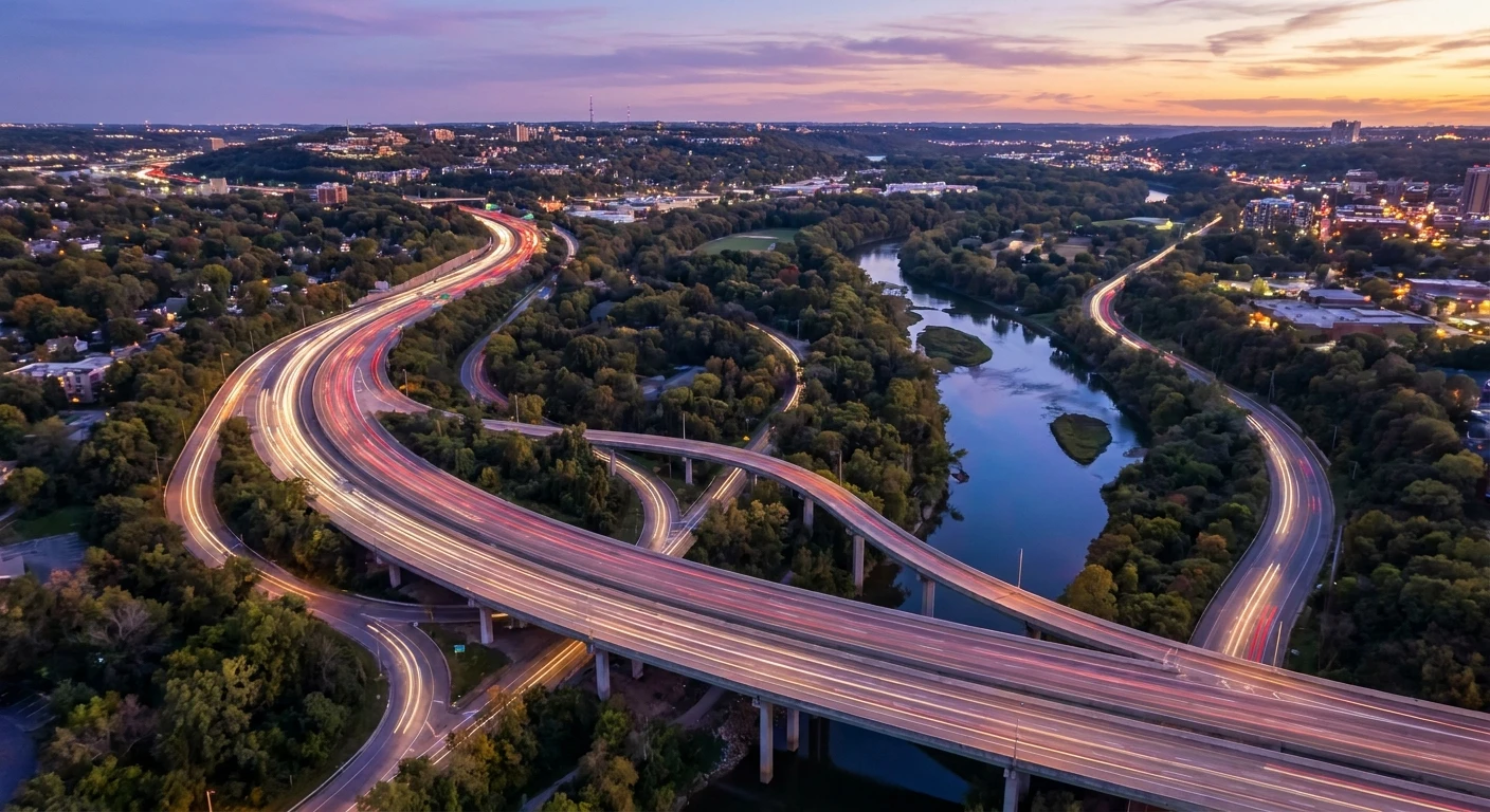
Mastering the Daily Commute: Navigating DVP Traffic
Dealing with DVP traffic on a daily basis requires a strategic mindset and a clear understanding of urban transportation dynamics. The Don Valley Parkway, an iconic and heavily utilized municipal expressway in Toronto, connects the northern suburbs at Highway 401 down to the downtown core via the Gardiner Expressway. When this roadway functions smoothly, it offers a scenic and highly efficient route through the natural landscape of the Don River Valley. However, predictable congestion has made it infamous among regular commuters. By examining the historical design choices, the physical layout of the valley, and the scientific principles behind traffic flow, drivers can better prepare for their journey. The goal here is not merely to endure the daily gridlock but to thoroughly understand the mechanical and human variables that create it. Armed with this knowledge, you can implement factual, tested strategies to optimize your travel time, reduce wear and tear on your vehicle, and maintain peace of mind during peak transit hours. A proactive approach transforms a frustrating stop-and-go experience into a manageable, routine part of your schedule.
Core Strategies for Minimizing Highway Delays
Understanding the severe impact of highway congestion is the first step toward reclaiming your time. The detriments of sitting idle on the highway extend far beyond simple time loss. Prolonged idling drastically increases vehicle emissions, accelerating environmental harm while simultaneously burning through costly fuel reserves. Furthermore, the psychological strain of stop-and-go driving elevates stress levels before the workday even begins. Conversely, effectively avoiding the worst of the congestion offers tremendous value. Consider two common examples of this value proposition in action. First, by shifting a morning departure time earlier by just thirty minutes, a driver might bypass the critical mass of southbound vehicles, effectively saving twenty to thirty minutes of travel time and ensuring a smooth arrival. Second, an informed commuter utilizing real-time API navigation tools might detect a severe collision near the Bloor Street viaduct and proactively detour onto Bayview Avenue, avoiding a catastrophic delay that could have lasted over an hour.
Read also: Guide: How Much Does 407 Cost Per KM? Exact Toll Rates; Honda Motocompo: The Ultimate Vintage Folding Scooter Guide.
To contextualize the predictable patterns of this expressway, examine the following breakdown of typical weekday conditions:
| Time of Day | Average Southbound Speed | Expected Congestion Level |
|---|---|---|
| 6:00 AM – 7:00 AM | 65 km/h | Moderate to Building |
| 7:30 AM – 9:30 AM | 25 km/h | Severe Gridlock |
| 10:00 AM – 2:00 PM | 80 km/h | Light to Moderate |
| 3:30 PM – 6:30 PM | 30 km/h | Heavy (Northbound predominantly) |
To consistently navigate these fluctuating conditions, implement these core practices into your daily routine:
- Leverage Predictive Mapping Software: Always activate GPS navigation prior to turning the key, even if you know the route by heart, to catch unpredictable anomalies and early accident reports.
- Master the Zipper Merge Technique: When lanes converge due to construction or maintenance, utilize all available lanes until the pinch point, then alternate entry. This utilizes maximum road space and prevents miles of single-lane backup.
- Maintain Route Flexibility: Familiarize yourself with the parallel arterial roads lining the valley so that diverting from the highway becomes a seamless, stress-free maneuver rather than a frantic last-second decision.
Origins of the Parkway
The concept of a high-speed arterial road cutting through the center of Toronto emerged during the massive post-World War II automotive boom. Planners recognized that the rapidly expanding northern suburbs required a dedicated, high-capacity link to the downtown financial district. Championed by Metro Toronto Chairman Frederick G. Gardiner, the project was seen as an engineering marvel of its era. Construction began in the late 1950s, requiring massive earth-moving operations and complex bridge engineering to traverse the steep ravines and the winding Don River. When the route officially opened in phases between 1961 and 1966, it represented the pinnacle of mid-century urban planning, promising rapid transit for a growing metropolitan population.
Evolution of Urban Congestion
Initially designed to handle an Average Annual Daily Traffic (AADT) volume of approximately 60,000 vehicles, the infrastructure performed admirably during its first decade. However, the subsequent population explosion across the Greater Toronto Area rapidly outpaced the highway’s static capacity. As suburban sprawl extended deeper into regions like Markham and Richmond Hill, the southern funnel of the Don River Valley bore the brunt of the commuting volume. Throughout the 1980s and 1990s, the concept of rush hour expanded from a brief sixty-minute window into a multi-hour endurance event. Planners attempted minor optimizations, such as lengthening on-ramps and improving signage, but the fundamental limitations of the physical space prevented any meaningful expansion of the roadway itself.
Modern State of Gridlock
Today, the infrastructure strains under the weight of well over 100,000 vehicles daily, severely exceeding its original design limits. The geographical constraints of the valley mean that widening the road to add additional passenger lanes is structurally and financially prohibitive, if not entirely impossible. The modern state of the commute is heavily dictated by a delicate balance; a single stalled vehicle or minor fender-bender immediately severs the capacity by one-third or more, triggering massive backups that can stretch all the way back to Highway 401. Consequently, transportation authorities have shifted their focus from expanding the road to managing the flow through digital overhead signs, rapid response tow trucks, and integrated transit planning.
The Physics of Phantom Traffic Jams
To truly master the commute, one must understand the fluid dynamics of highway travel. Vehicles moving in sequence mimic the behavior of particles in a fluid. When density reaches a critical threshold, the flow becomes unstable. This instability breeds what traffic engineers call the phantom jam. When one driver taps their brakes unnecessarily, the driver behind them reacts with a slightly harder brake application. This reaction multiplies exponentially backward through the chain of cars. Within minutes, vehicles kilometers behind the initial event are forced to a complete stop, despite there being no physical accident or lane closure. This shockwave effect travels backward against the flow of cars at a predictable rate, turning a perfectly clear stretch of asphalt into a parking lot.
Topographic Constraints of the Don Valley
Compounding the phantom jam phenomenon is the unique topography of the route. Unlike perfectly flat, straight interstate highways, this municipal road traces the natural meandering path of a river basin. The continuous series of curves and rolling inclines constantly force drivers to adjust their speed. The northbound climb near Wynford Drive, for example, represents a significant grade that naturally causes heavy commercial vehicles to decelerate. This localized deceleration acts as a permanent bottleneck.
- Kinetic Wave Theory: Explains how disturbances in vehicle spacing propagate backward through densely packed lanes, creating invisible walls of stationary vehicles.
- Capacity Drop Phenomenon: Once a highway transitions from free-flowing to stop-and-go, the total maximum number of cars that can pass a given point drops by up to twenty percent.
- Topographical Bottleneck Activation: Specific curves and blind crests along the valley inherently trigger cautious braking, automatically generating shockwaves during peak density hours.
Step 1: Pre-Departure Intelligence
A successful commute begins long before you reach the driveway. Establish a habit of consulting reliable digital mapping tools or municipal traffic application programming interfaces (APIs) while you are still gathering your belongings for the day. Look specifically for deep red markers indicating heavy localized congestion or alerts for disabled vehicles. Deciding whether to take the highway or stick to surface streets must be done before you are actively driving, ensuring you are not distracted behind the wheel.
Step 2: Optimizing the On-Ramp Approach
The on-ramp is the critical transition zone that sets the tone for your drive. The primary goal is to match the exact speed of the vehicles in the right-hand lane before the ramp ends. Timid merging—attempting to enter the highway at a drastically lower speed—forces the mainline vehicles to brake abruptly, instantly generating a localized shockwave. Accelerate smoothly, identify a safe gap early, and commit to the merge to maintain the overall momentum of the system.
Step 3: Lane Selection Strategy
Once established on the highway, strategic lane positioning heavily influences your experience. The right lane suffers from constant friction due to entering and exiting vehicles, causing erratic speed changes. The far-left lane often attracts aggressive driving and sudden heavy braking. The middle lane consistently offers the most balanced, steady pace. By committing to the center lane, you minimize your exposure to merging friction while avoiding the volatile speed fluctuations of the passing lane.
Step 4: Maintaining Following Distance
The single most effective tactic for neutralizing phantom traffic jams is maintaining a generous buffer zone between your front bumper and the vehicle ahead. When you leave a gap of three to four seconds, you grant yourself the physical space to absorb sudden speed reductions simply by easing off the accelerator, rather than instantly applying the brakes. This smooths out the flow for everyone behind you and dramatically reduces the risk of a rear-end collision during unexpected stops.
Step 5: Utilizing Alternate Arterial Roads
When the digital signs overhead flash warnings of a major closure ahead, you must have an alternate plan ready to execute. Familiarize yourself with the parallel north-south corridors such as Victoria Park Avenue, Bayview Avenue, and Broadview Avenue. Knowing exactly which off-ramp connects to which surface street allows you to bypass catastrophic highway failures efficiently. Sometimes, navigating traffic lights on a surface street yields a far faster arrival time than sitting in complete immobility on the expressway.
Step 6: Timing the Off-Ramp Exit
Anticipation is crucial when approaching your final destination. Begin positioning your vehicle into the right-hand lane at least two kilometers before your designated exit. Late lane changes and sudden dives toward the off-ramp not only infuriate surrounding drivers but actively contribute to the dangerous braking cascades that gridlock the entire corridor. Signal early, establish your position, and decelerate only once you have fully entered the deceleration lane.
Step 7: Post-Commute Vehicle Maintenance
Daily exposure to heavy congestion places unique mechanical stress on your vehicle. The constant cycling between acceleration and abrupt stopping accelerates the wear on brake pads and rotors. Furthermore, idling in dense traffic reduces the airflow across the radiator, testing the limits of your engine’s cooling system. Schedule routine inspections of your transmission fluid, coolant levels, and brake hardware to ensure your vehicle remains reliable under the rigorous demands of municipal highway driving.
Myths and Realities of the Commute
Myth: Changing lanes frequently and weaving through gaps will get you to your destination much faster.
Reality: Extensive data analysis demonstrates that aggressive lane weaving rarely saves more than a few seconds on a typical commute. Instead, it exponentially increases the probability of collisions and forces other drivers to brake, which ironically worsens the overall congestion you are trying to beat.
Myth: The highway is completely gridlocked twenty-four hours a day, seven days a week.
Reality: While peak hours are heavily saturated, off-peak periods, particularly between 10:00 PM and 5:00 AM, typically feature free-flowing conditions that allow drivers to safely maintain the posted ninety kilometers per hour speed limit.
Myth: Expanding the highway by adding just one more lane in each direction would permanently eliminate all the delays.
Reality: The well-documented principle of induced demand proves that increasing road capacity simply encourages more people to drive. Any temporary relief is quickly erased as new drivers fill the additional space, returning the highway to its baseline level of saturation.
Myth: Driving on the weekend guarantees a smooth, uninterrupted trip down to the downtown core.
Reality: Weekend travel is frequently heavily disrupted by scheduled municipal maintenance, construction closures, and major public events. These localized disruptions can often create delays that rival or exceed typical weekday rush hour conditions.
Frequently Asked Questions
Why is DVP traffic so consistently heavy?
The core issue is that the daily volume of vehicles drastically exceeds the physical design capacity of the road. Built in the mid-twentieth century for a much smaller population, the infrastructure simply cannot process the modern influx of cars funneling in from the sprawling northern suburbs.
What is the absolute best time to drive on the DVP?
To experience entirely unimpeded travel, driving late at night or very early in the morning—specifically before 5:30 AM or after 9:30 PM—is highly recommended. During these windows, volume is low enough to prevent bottleneck activation.
Are there any financial tolls required to use the Don Valley Parkway?
No, it remains a toll-free municipal expressway. While proposals to implement tolling for revenue generation and congestion management have been debated by city councils in the past, none have been enacted to date.
How exactly do weather events affect the driving conditions?
Rain, snow, and even heavy fog mandate increased following distances and lower speeds. Because the road follows a winding valley path, standing water and reduced visibility instantly cut the operational capacity of the road, triggering severe backups almost immediately upon the start of precipitation.
Can the concept of induced demand explain the current congestion?
Absolutely. Urban planners recognize that the existence of the highway itself shaped the suburban development of the region. If capacity were miraculously doubled tomorrow, the convenience would attract thousands of new drivers from transit or alternate routes until the congestion reached equilibrium once again.
What are the primary alternate routes available when the highway is closed?
If the main route is impassable, drivers typically divert to parallel surface streets. Bayview Avenue runs closely along the valley’s edge, while Broadview Avenue handles downtown approaches, and Victoria Park Avenue serves as a reliable eastern alternative.
Are there High Occupancy Vehicle (HOV) lanes available?
The mainline passenger lanes do not feature standard HOV lanes for carpoolers. However, there are dedicated bus bypass lanes on the shoulders in specific sections, allowing public transit vehicles to bypass the worst of the congestion during peak hours.
In conclusion, while DVP traffic represents a formidable daily challenge, it is an entirely predictable system governed by volume, topography, and driver behavior. By abandoning aggressive driving habits in favor of strategic planning, smooth merging, and maintaining appropriate buffer zones, you protect your vehicle and your sanity. You now possess the factual insights and the actionable framework required to optimize your route. Apply these strategies on your next drive, stay continually informed regarding real-time conditions, and take back control of your daily commute.